IMAGE GALLERY
As you might imagine, over the years we’ve uploaded LOTS of images to Earth Conservancy’s website. Although some of what you’ll find below are still featured on pages and posts, many of what we’ve collected here are no longer used. Any questions about what you see? Feel free to reach out to us by emailing Elizabeth W. Hughes.

EC's colleague, Jackie Munro, who passed away in 2014.
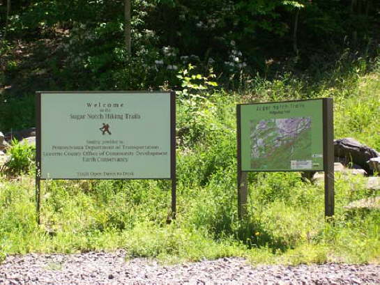
The Sugar Notch Trail System has a welcome sign and large-scale trail map.

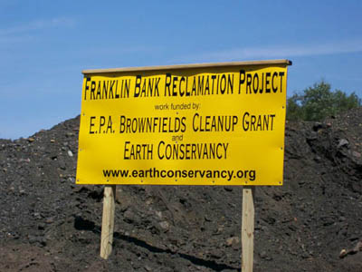
The Franklin Bank project took a mine waste holding area and reclaimed it for use as a residential area. The 15-acre property was sold and will become a site with single family homes.
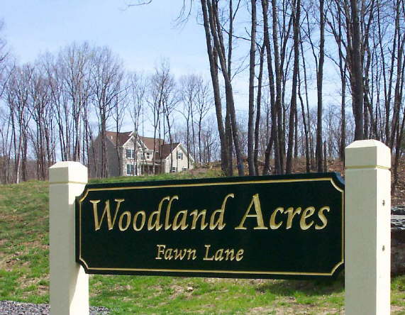
Woodland Acres is a residential development created by Earth Conservancy.
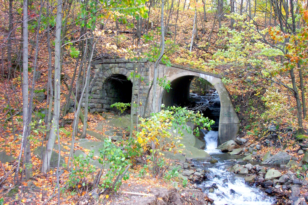
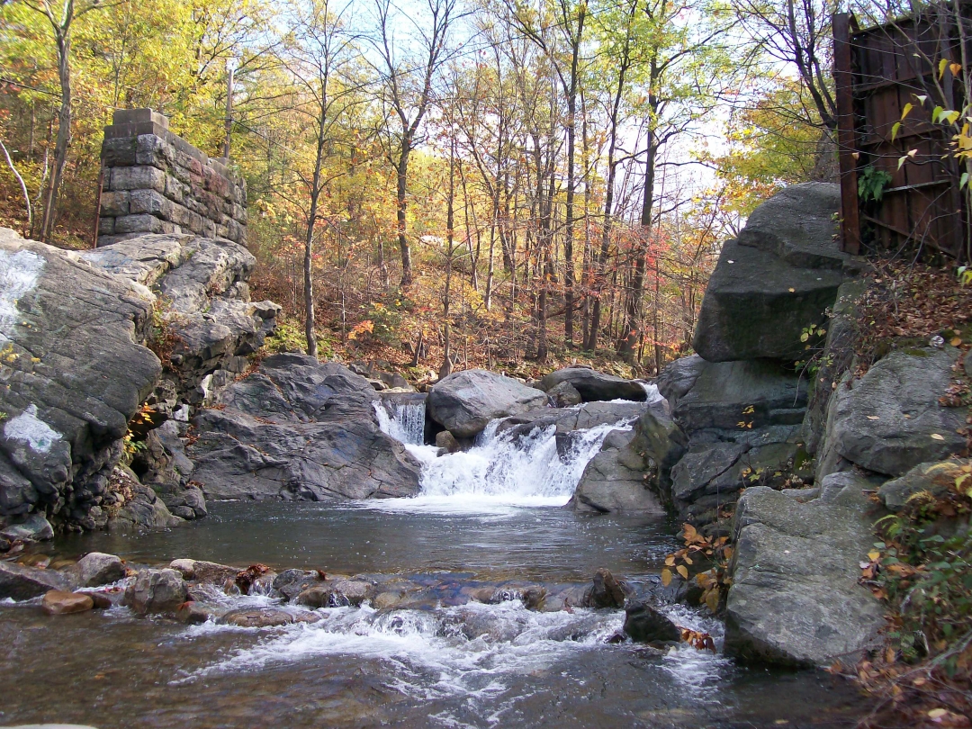
You will find an old rail bridge along the Sugar Notch Ridgetop Trail.
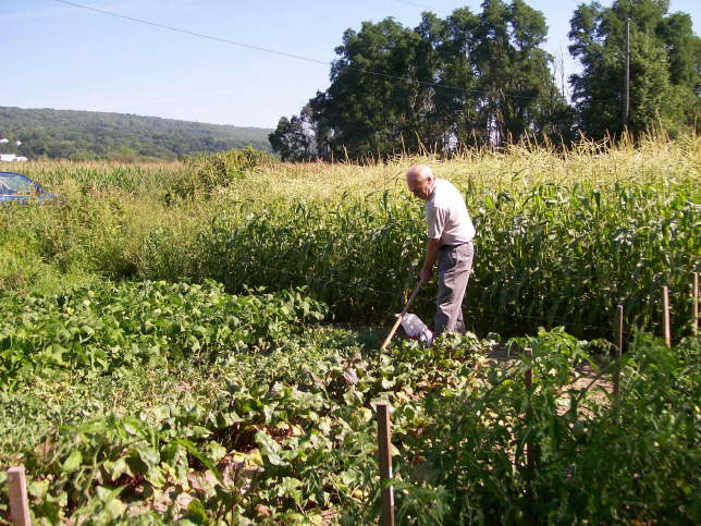
EC operates a community garden, which provides garden plots free of charge to area residents on a seasonal basis.
Franklin Bank 2

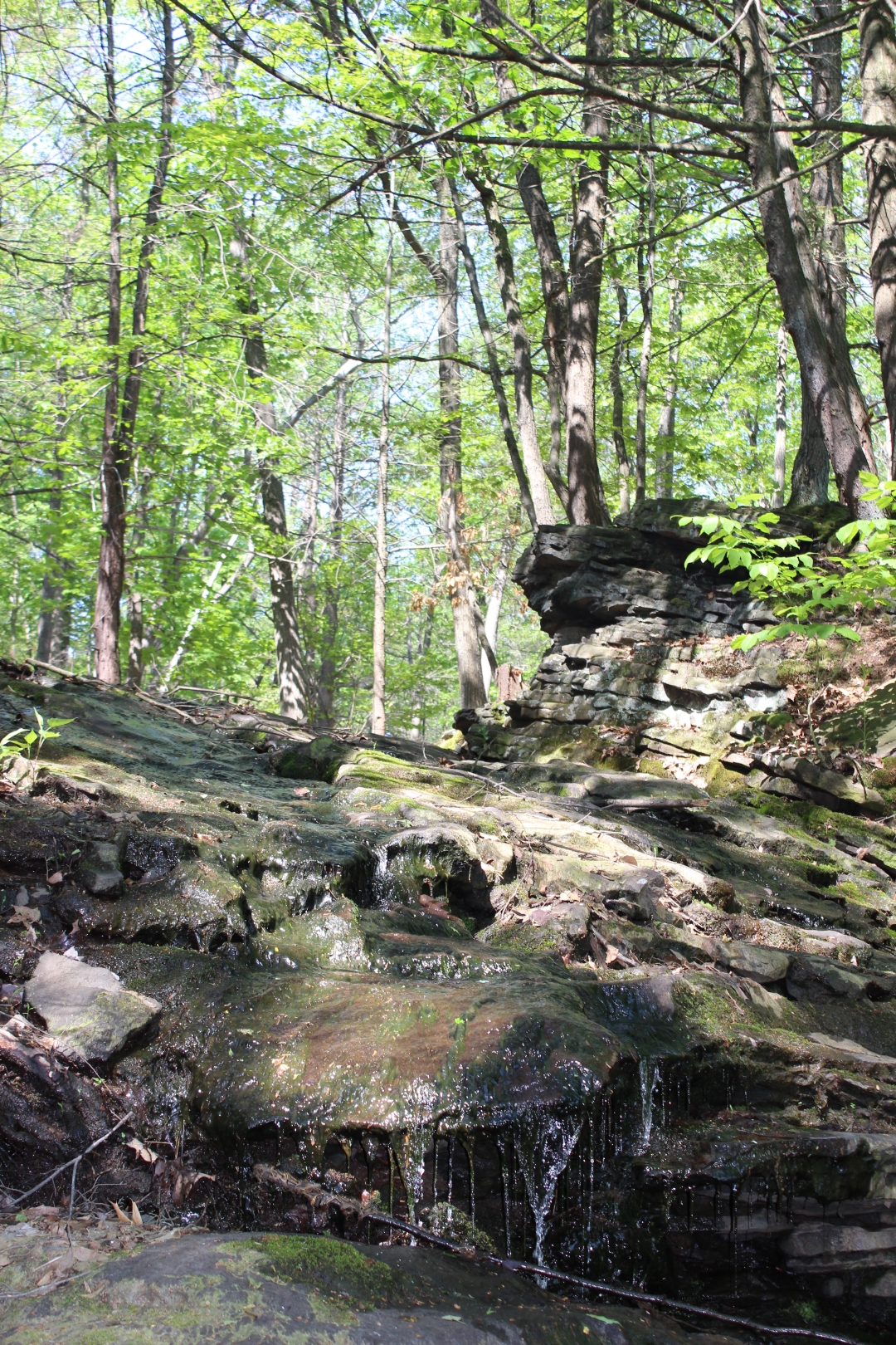
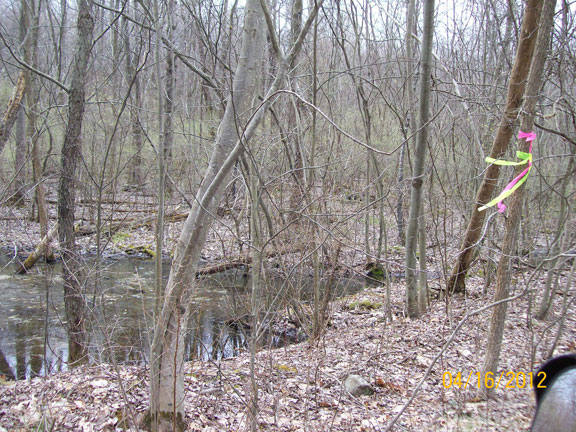
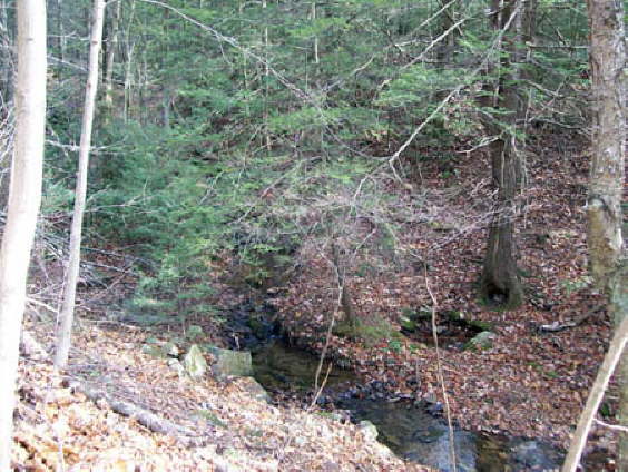
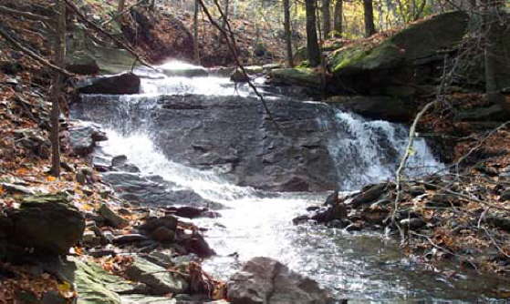
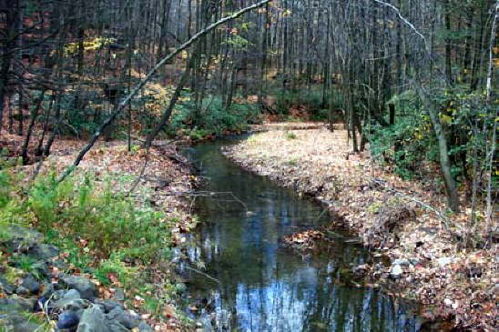
Stream health is good on the upper Nanticoke Creek in Warrior Run, but flow quickly disappears underground past this point.
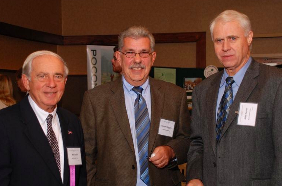
EC's Mike Dziak, President/CEO, Richard Ruggiero Sr., Property Documentation Specialist & Survey Coordinator, and John Renfer, Sr., Executive Administrator, attend the 2011 Northeast PA Environmental Partners Dinner.
2012 Northeast PA Environmental Award winners

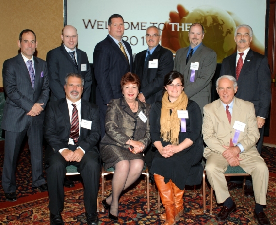
Winners of the 2013 Environmental Governors Awards
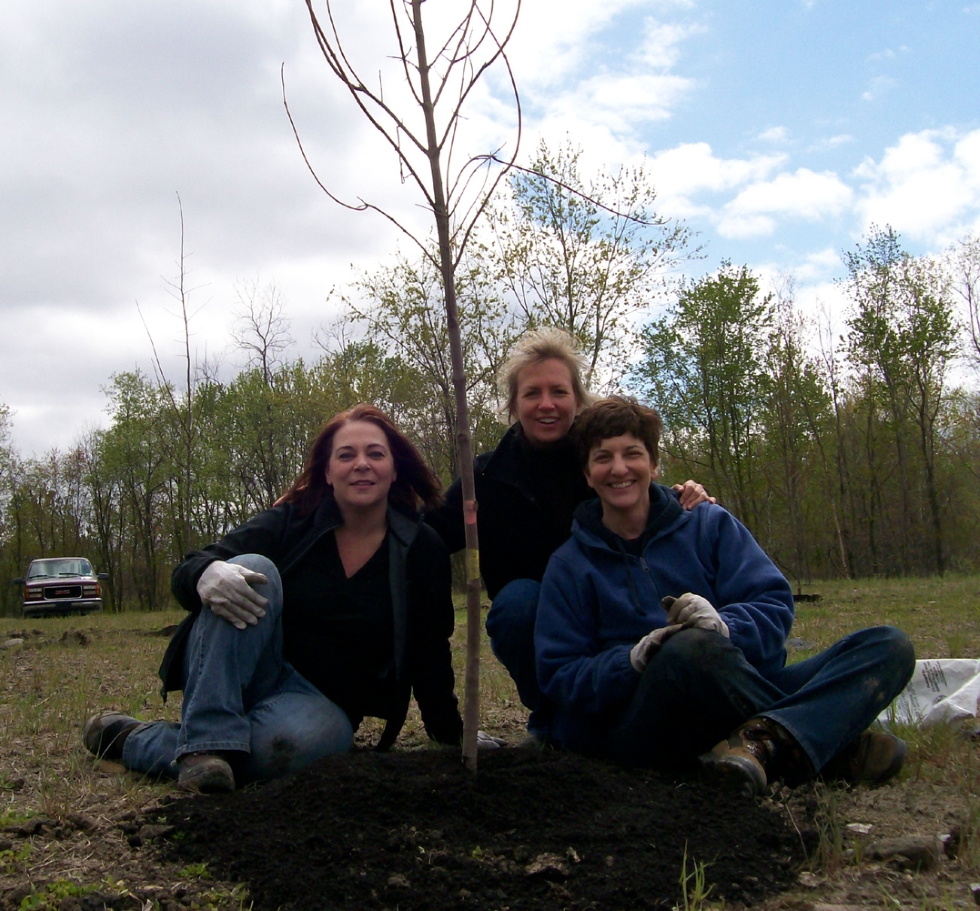
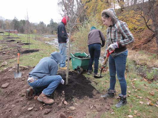
PA Environmental Council's reforestation program helped EC to plant 15 trees of varying species at EC's Espy Run Wetland area. Pictures left to right: Angela Vitkoski, PEC Office & Project Manager, Jacqueline Dickman, EC Dir. of Public Affairs & Development, and Janet Sweeney, Director, PEC Northeast Regional Office.
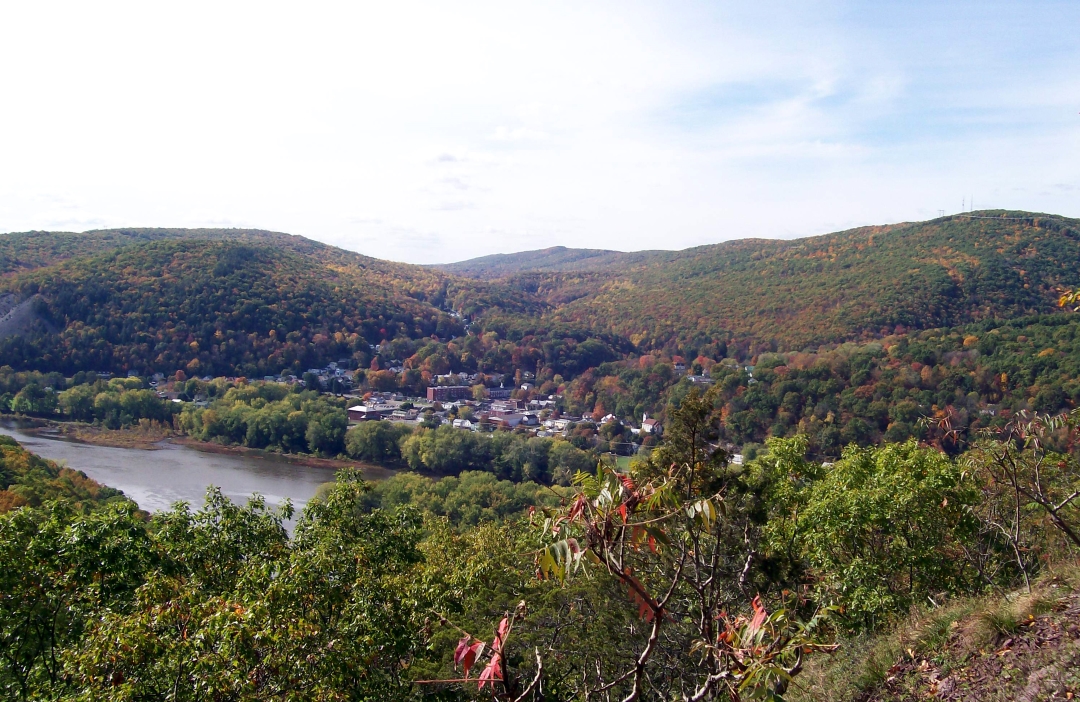
Hikers on the Mocanaqua Loop Trail System can see Shickshinny from one of the lookout points.
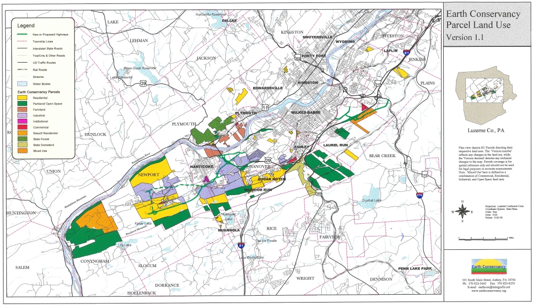
Map from Earth Conservancy's original Land Use Plan

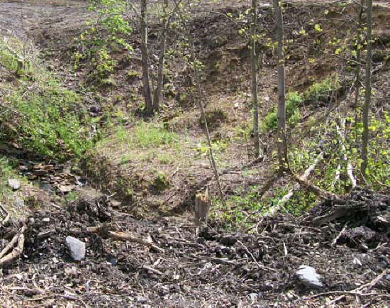
An old stone culvert that historically had spanned a section of the Nanticoke Creek. Currently, the creek is blocked further upstream by a culm bank.

NEWS & EVENTS
A spiderweb appears through the mist one morning near the new Espy Run stream channel.
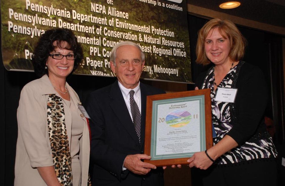
At left, Colleen Stutzman, Asst. Regional Dir., PA DEP presents Mike Dziak, President/CEO, Earth Conservancy the Environmental Partnership Award 2012 with Diane Madl, Environmental Education Specialist, DCNR.
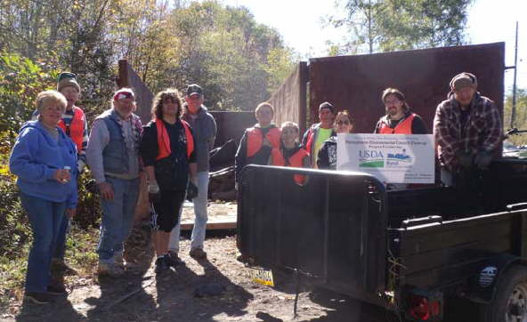
By conducting the cleanups, groups like the Newport Township organization help to improve the environment and quality of life for people living around the region.
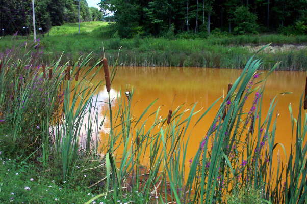
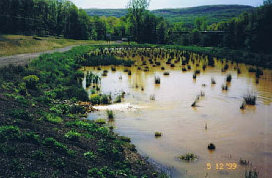
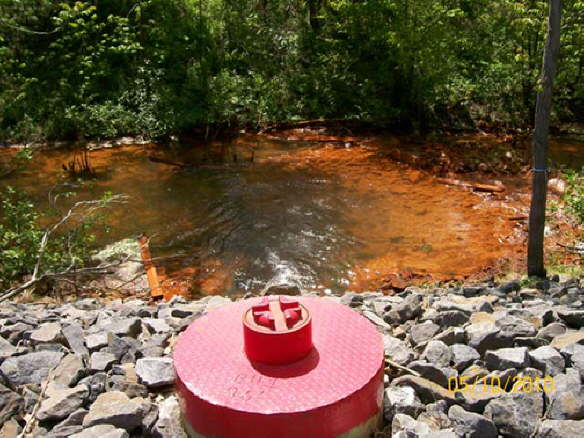
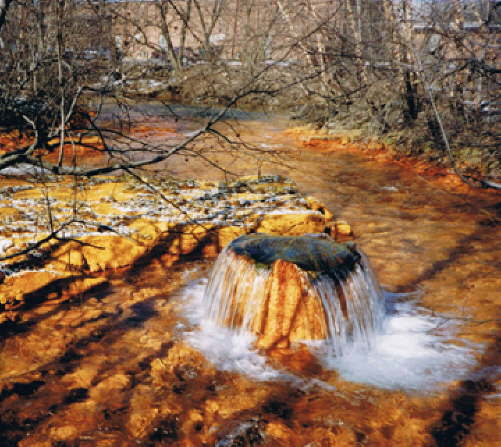
Espy Run Seep

EC participates in EPCAMR's Monarchs on Minelands program.
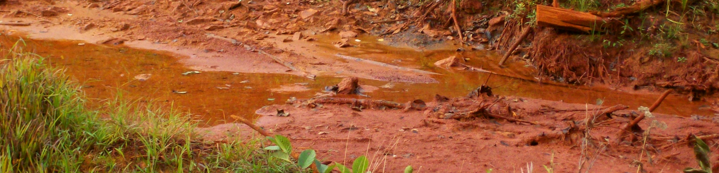
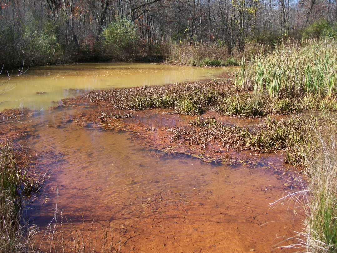
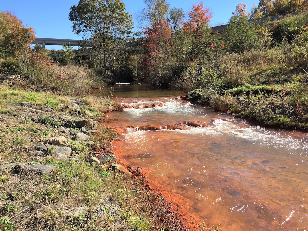
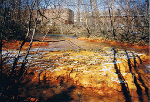
Bed of Espy Run, covered in iron precipitate from AMD.
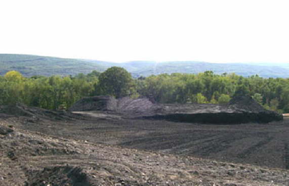
Part of the Huber Bank, pre-reclamation.
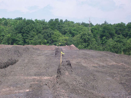
The finished product is a rich fertile compost that can be used by Luzerne County residents and is used on many of EC's projects.
Warrior Run Slope Street, after reclamation.

Earth Conservancy Compost Facility
Penobscot Ridge Mountain Bike Trail
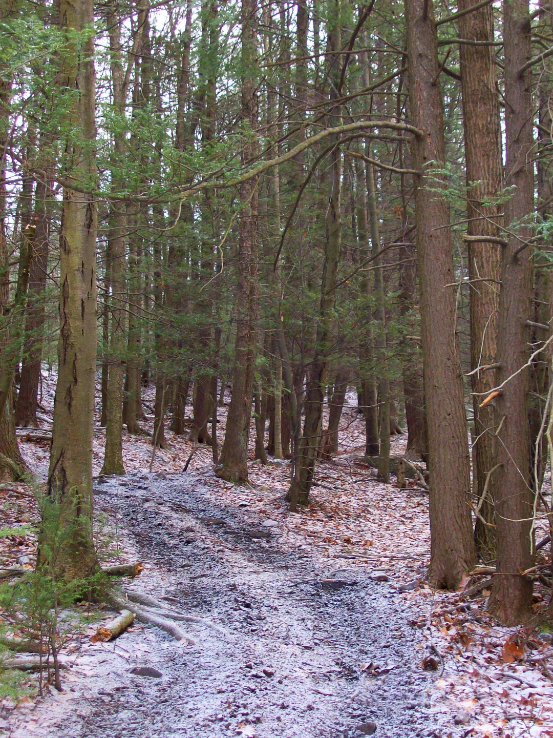
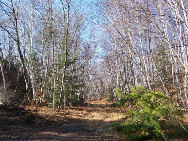
Sugar Notch Trail
The Ashley Planes are listed in the National Register of Historic Places. At the height of mining in the region, the Planes once helped to bring a million ton of coal out of the valley per year.
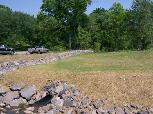
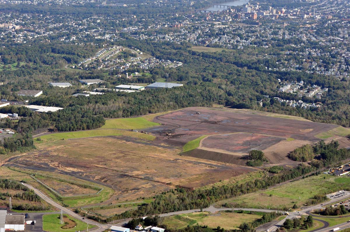
This site looks vastly different than prior to its reclamation. The project made way for a 65-acre youth recreation area, 50 acres for residential development, two hiking trails and 137 acres remain green space.
Hanover 9B, pre-reclamation
Franklin Bank, after reclamation, covered in topsoil.
Hanover 9A, pre-reclamation
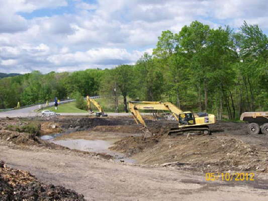
Huber IV reclamation underway.
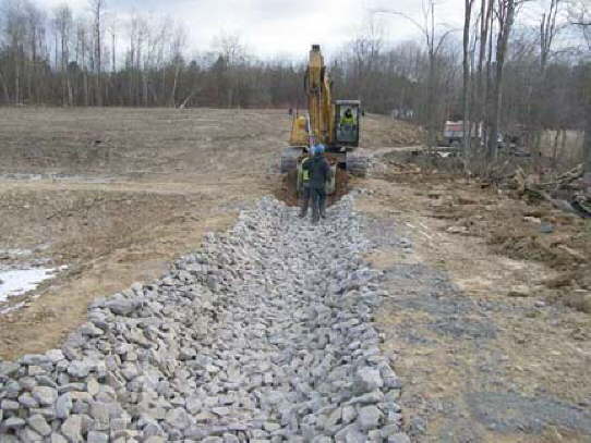
The stone culvert channels cleaned water from the settling ponds of the passive wetland treatment system and directs it into Espy Run creek.
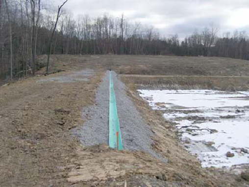
The blue pipe allows water diverted from the Espy Run Discharge to spill into the two settling ponds, where iron is removed from the water.
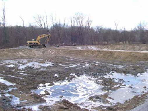
Settling ponds in passive Acid Mine Drainage treatment systems allow heavy iron particles to precipitate out of the water when it passes through the ponds.
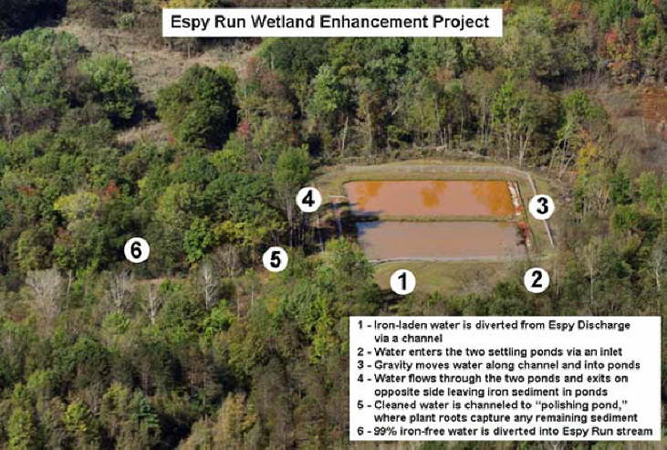
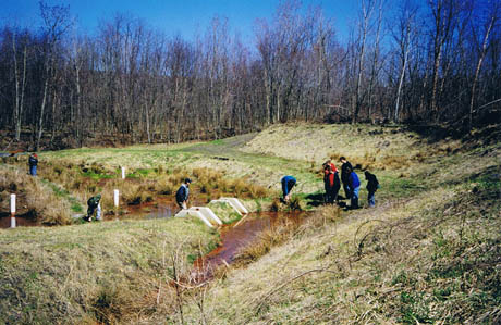
Follow the numbers to read how acid mine drainage is removed from Espy Run through the passive wetlands system.
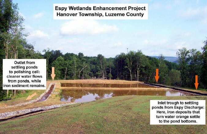
The Espy Run Enhancements Project has improved capacity and efficiency in the removal of iron from the Espy Run Discharge. Seen here are two settling ponds that hold the iron laden water and allow the iron to settle to the bottom.
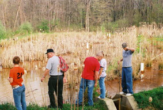
Each year, high school and college classes visit both EC wetland sites to test the iron levels of the water before entering and after exiting the wetland cells.
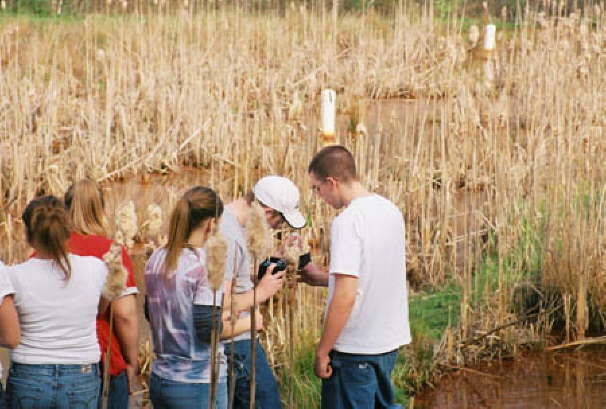
Outdoor excursions allow students to experience what they learn in the classroom.
After the stream water passes through the wetlands it is returned to the steam virtually free of iron deposits
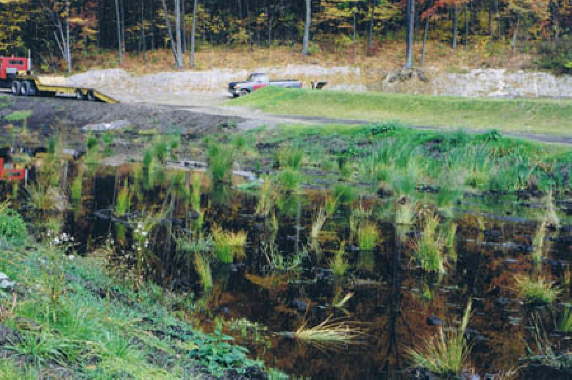
This photo shows the second pond at the Dundee Road Educational Wetland site after years of plant growth with a strong well-established root system.
This photo shows the Dundee first cell filled with iron-laden water. The iron will slowly drop to the bottom as the water passes through pond.
The Dundee Road Educational Wetlands are shown here shortly after completion. This pond allows the iron to settle to the bottom while cleaner water flows to the second pond.
The plants will multiply and fill the pond with a sponge-like root system that captures the iron in the water, thus cleaning it of the iron contaminant.
This photo shows the second settling pond shortly after grasses were planted. The root systems of grasses and other plants hold the iron like sponges as the cleaned water flows back into the stream.
Franklin Bank early in the project.
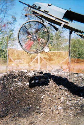
After several months of decoposting, materials are passed through a filter system to remove unwanted materials.
Finished compost is used in many of Earth Conservancy's projects.
Franklin Bank mid-project.
Franklin Bank near completion.
The site was covered by small pits like this and uneven topography.
A finished Hanover 9A.
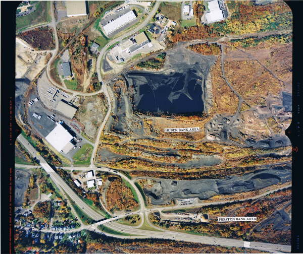
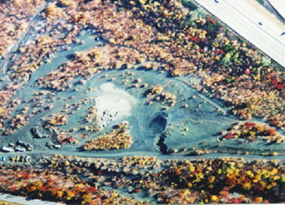
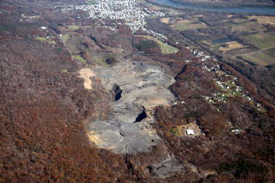
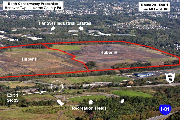
This photo shows an aerial view of Huber III and Huber IV parcels. A large standing pool of water and piles of culm can be seen around the site. Both sites are now reclaimed.
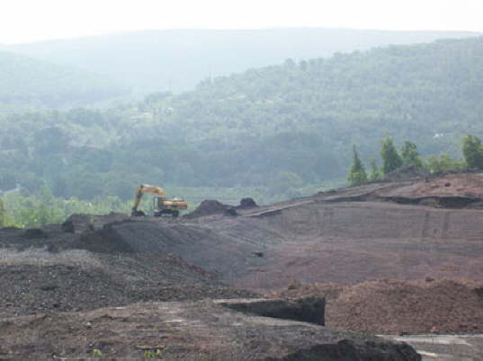
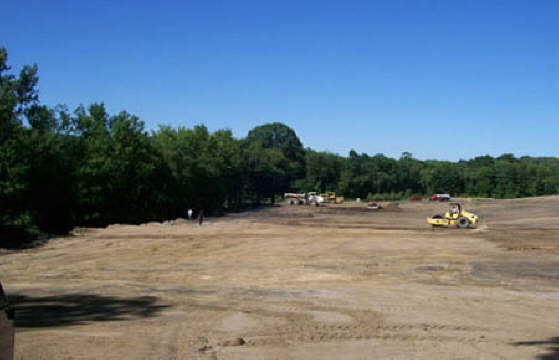
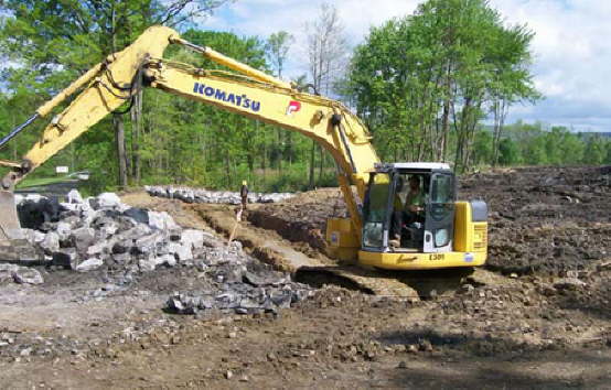
Mid-construction on Huber IV.
This is a sample of how the Hanover 9 site looked prior to reclamation.
Work begins on a culvert on the Hanover 9A project
Work begins on Hanover 9A.
The finished Huber III and Huber IV sites have vastly improved the environment and the view.
A new road was made into the Huber IV site.
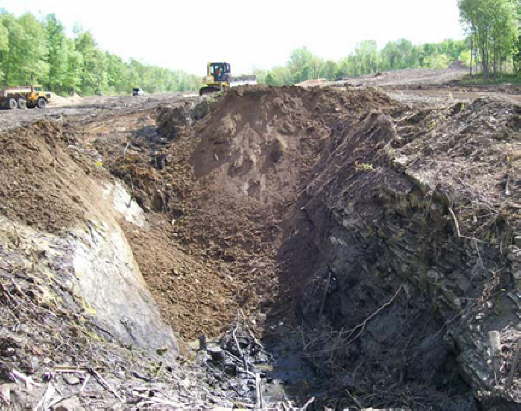
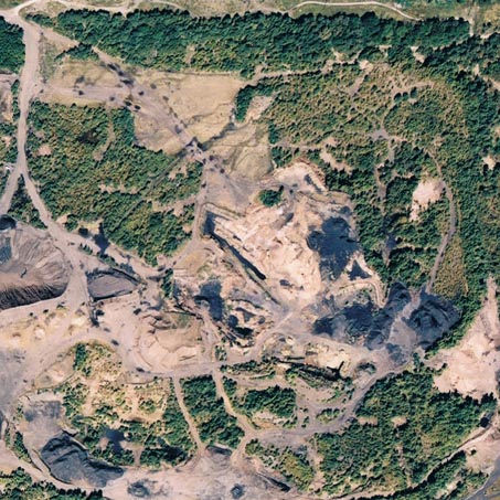
While Huber III had a large pit to be filled, Huber IV was covered by large culm piles and pits like this.
Much of EC's lands are in the PA Game Commission's Cooperative Forest-Game Program.
Areas included in the cooperative program are available to the public for the same recreational uses as Game Commission-owned land.
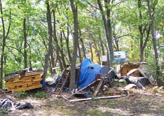
With so much open space in northeast Pennsylvania, illegal dumping has become one of the greatest problems with which property owners must contend, including EC.
Sugar Notch Run passes through the recreation area.
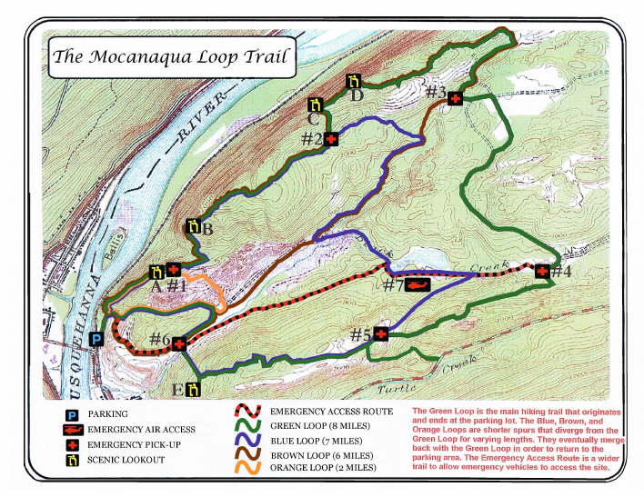
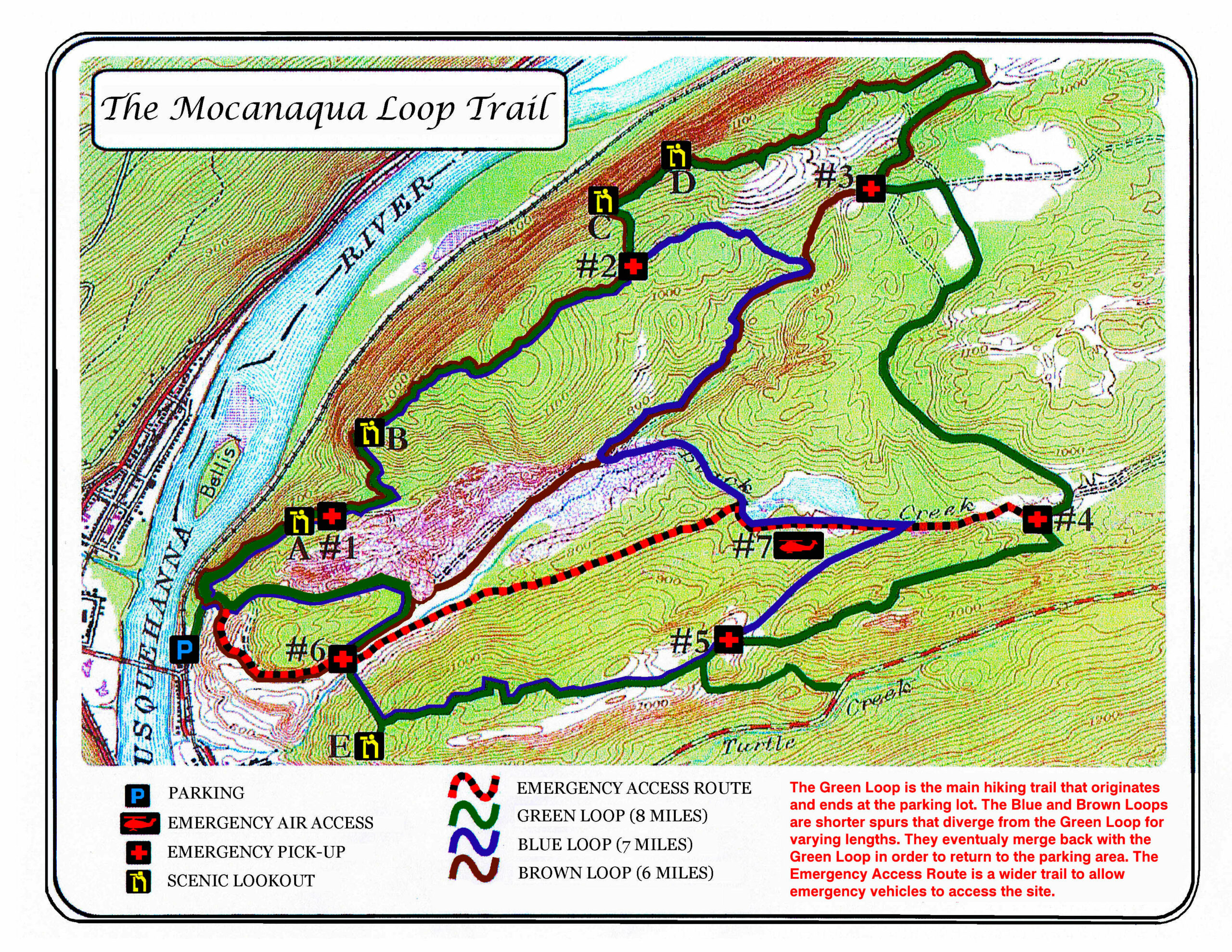
The Mocanaqua Loop Trail System map can be downloaded and printed. This should not replace more recent versions of the map, available from PA DCNR.
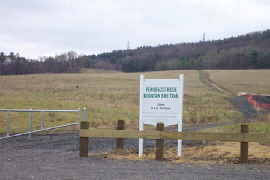
The Penobscot Ridge Biking Trail has picnic tables and grills.
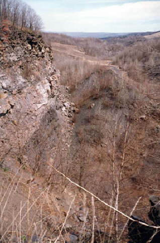
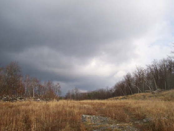
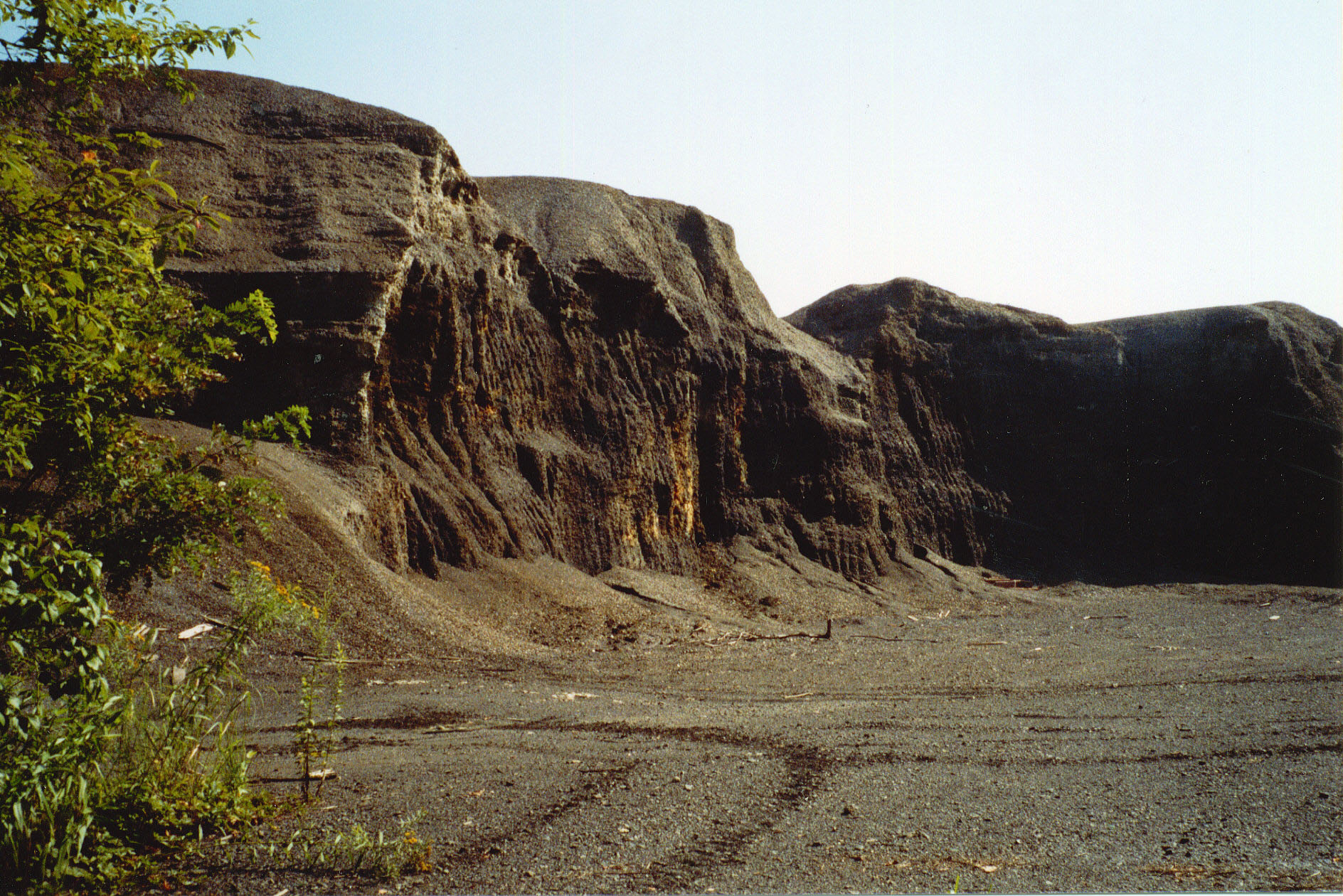
Anthracite mining resulted in highwalls, which were created when mountainsides were stripped to access coal. They can be found on some of EC's lands and pose a dangerous risk.

Mike Dziak, President/CEO Earth Conservancy, with Harry Forbes, Northeast Regional Director for Governor Corbett at the 2012 dinner for the Governor's Awards for Environmental Excellence.
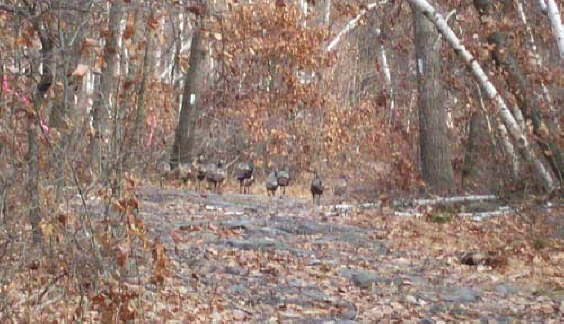
Wild turkeys are a common sight along the Sugar Notch Trail.
Hikers on the Ridgetop Trail will see Sugar Notch Run.
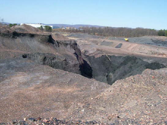
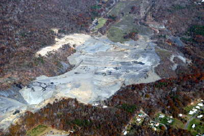
The PA Dept. of Environmental Protection Bureau of Abandoned Mine Reclamation began the $3.47 million reclamation of the 90-acre site, which was approximately 300 feet deep.
Avondale pit midway through reclamation.

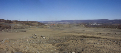
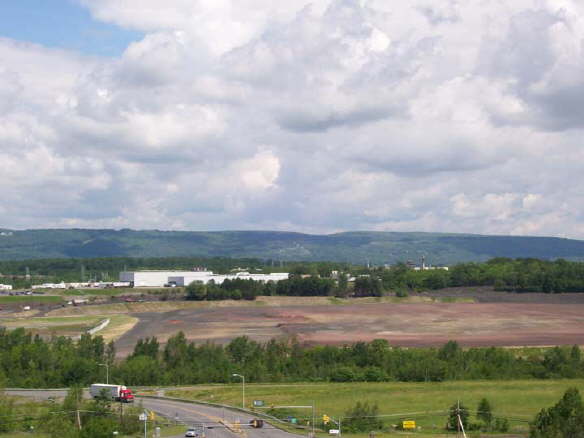
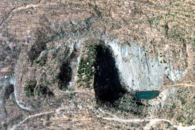
Panoramic view of the nearly completed Avondale Pit project.
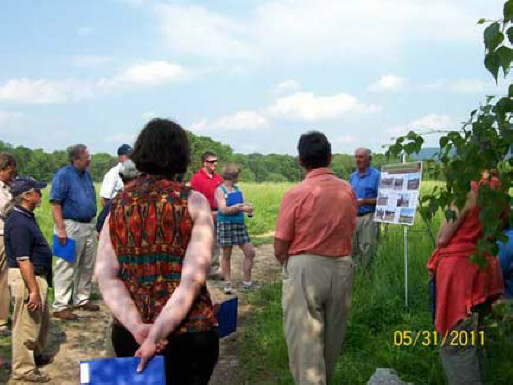
EC President/CEO Mike Dziak (left of poster) discusses an EPA funded silt pond reclamation project for which EC partnered with the Chesapeake Bay Foundation to use chicken manure-based compost as a soil additive. Attendees were professors in PSU's College of Agricultural Sciences.
This Askam Borehole was drilled after the original collapsed in 2008 due to iron slowly wearing away the pipes. The new piping is stainless steel.
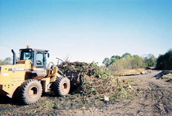
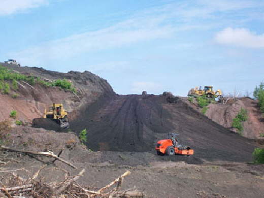
Materials are moved into piles at the compost facility to be passed through the grinder.
This borehole was drilled in the 1970s to relieve underground water pressure in the mines.
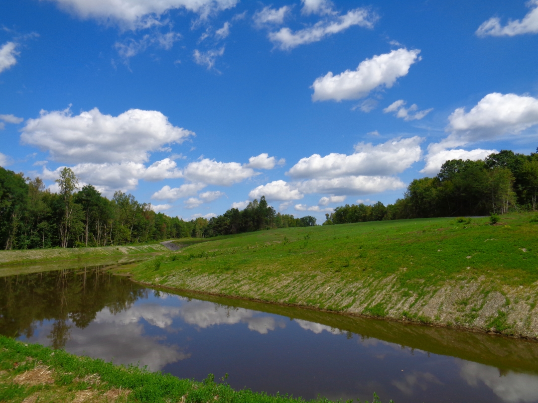
The Concrete City Silt Pond Reclamation Project remediated an area where mining refuse had been stored and a pond formed.
Grass was planted at the Concrete City site to stabilize the soil.
The Concrete City silt pond project, mid-construction.
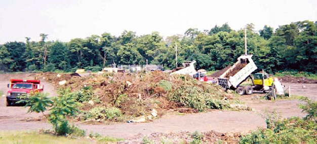
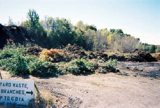
Composting begins with the dropping off of yard waste material.
Christmas trees are a popular item that residents bring to the facility.
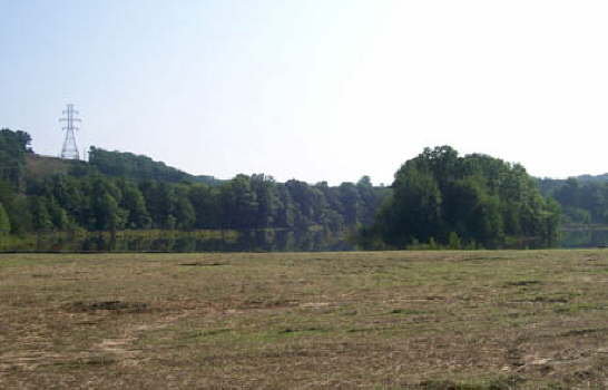
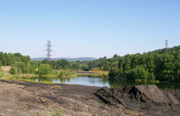
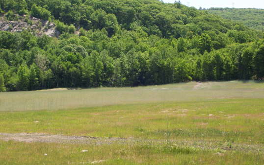
The reclaimed site now has a cleaned and level green area with a pond. The area will remain green space.
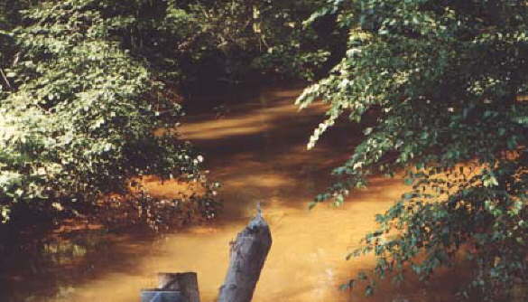
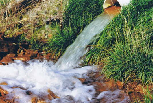
This photo shows Espy Run highly-laden with AMD iron deposits, which turns the water orange.
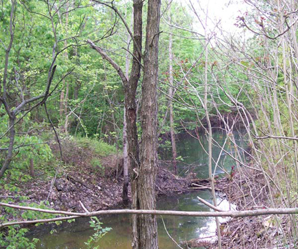
Nanticoke Creek is also impacted by acid mine drainage (AMD).
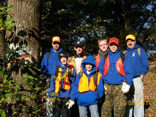
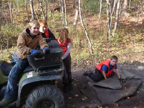
Boy Scout Troop No. 379 from Wapwallopen, PA, United Church of Christ, took to the trails to help Earth Conservancy mark trails at the Mocanaqua Loop Trail System.
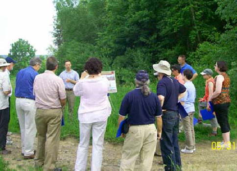
Professors from PSU's School of Agricultural Sciences listen as Harry Campbell, PA Scientist Advocate with the Chesapeake Bay Foundation, discusses soil amendment projects.
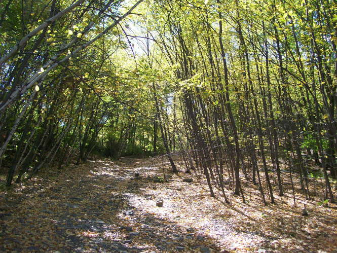
The Sugar Notch Trail System is wide and clearly marked.
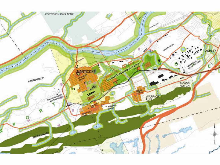
The "Thinkbelt" is one option for responsible development of lands in the Lower Wyoming Valley. See the South Valley Corridor Lands Reuse Analysis and Sustainable Redevelopment Framework report on in the Land Use Plans tab of the website for more information.
Original Earth Conservancy logo.
Concrete City silt pond during reclamation.
Loomis Bank reclamation.
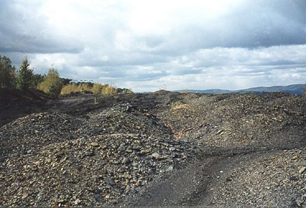
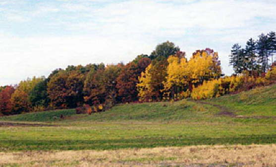
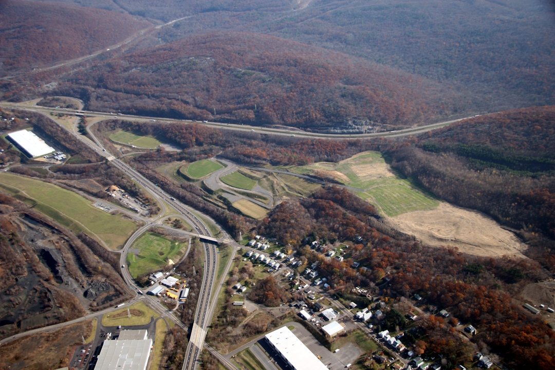
Example of a mine-scarred landscape under Earth Conservancy's ownership.
After reclaiming the area that became the recreation park, Earth Conservancy reclaimed this adjacent 50-acre area in Sugar Notch that is slated for residential use.
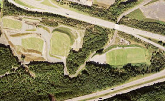
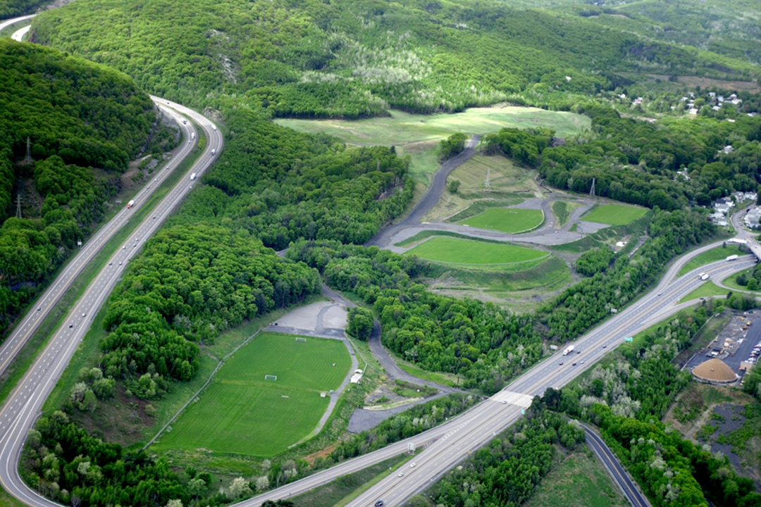
This aerial shot shows both the lower and upper fields of the Greater Hanover Area Recreation Park.
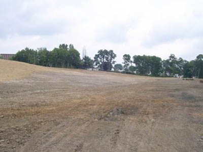
This is the area of the Greater Hanover Area Recreation Park, prior to reclamation. The lands were left in an environmentally degraded state and supported nothing but scrub vegetation.
Another view of the pit reclamation at mid point.
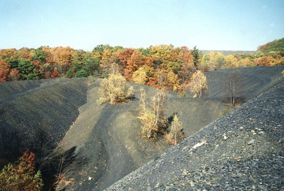
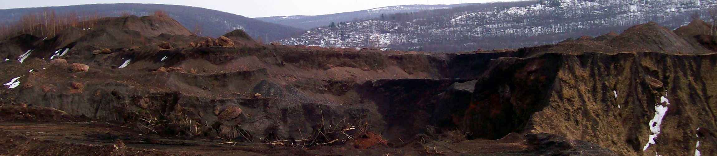
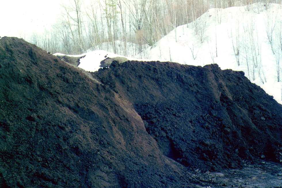
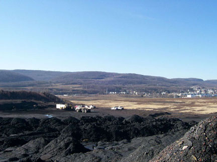
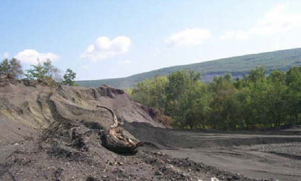
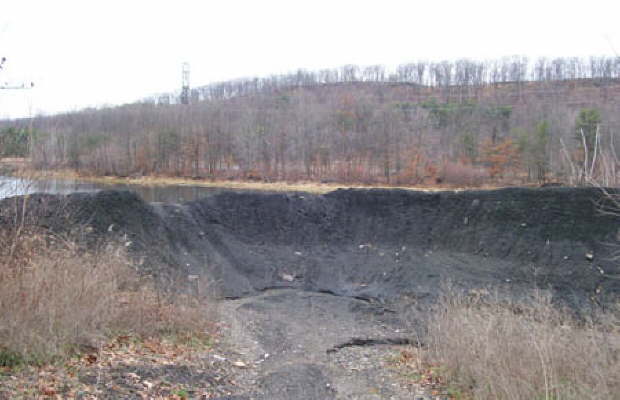
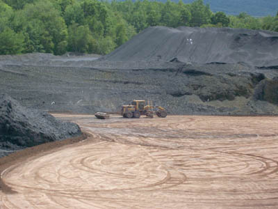
Part of the West End culm bank near Mocanaqua. These large piles of waste rock can be found on many parts of EC's lands. When rain or snowmelt permeates the culm, AMD is produced in the watersheds.
Pennsylvania Environmental Council (PEC), supported by a grant from PA American Water, completed a tree planting with local college students along Huntsville Creek near their Trucksville facility, off of Hillside Road. Earth Conservancy contributed compost for the project.
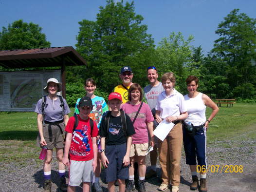
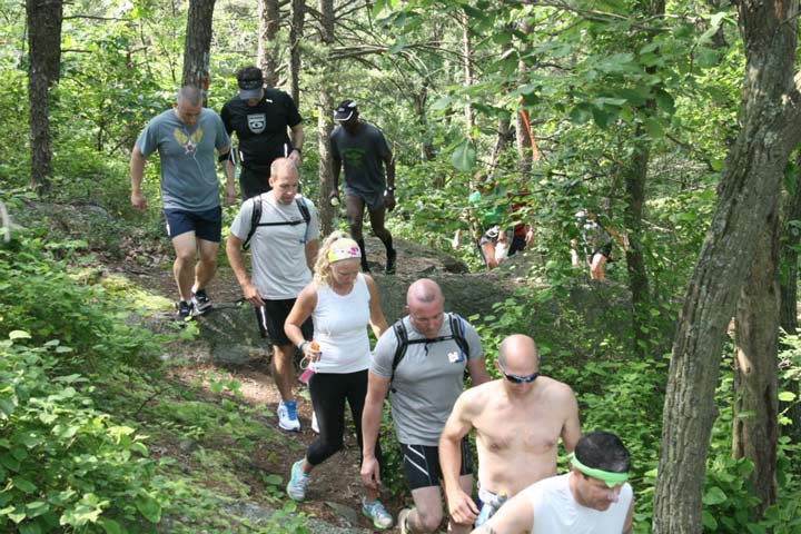
Hikers participate in the annual National Trails Day event, this one held at the Mocanaqua Loop Trail System.
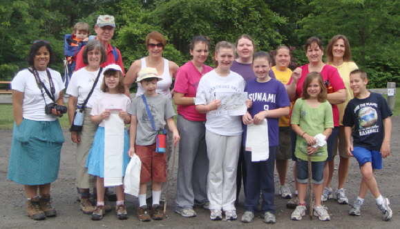
Participates in the American Hiking Society's National Trails Day catch glimpses of the town across the river from overlooks along the looping path system.
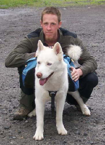
Even dogs get into the action on National Trails Day!
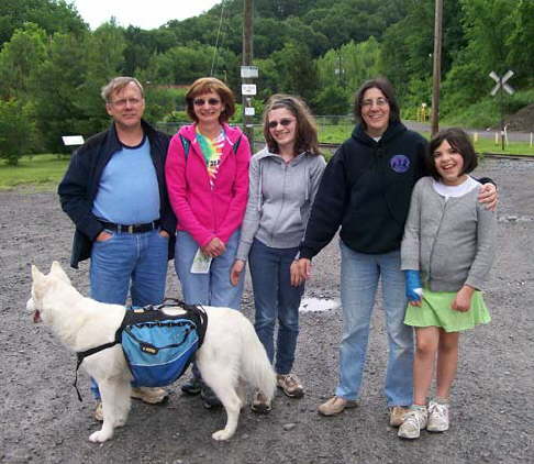
The American Hiking Society sponsors National Trails Day each year to promote outdoor active lifestyles. Pictured at EC's Mocanaqua Loop Trail is: the Sorokin family (left), Michele Shasberger (right), with Live Well Luzerne County, and daughter Isabelle Polgar.
The Newport Township Community Organization holds illegal dumpsite and community cleanups annually. Here, volunteering kids have some fun.
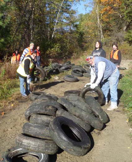
One of the greatest problems at illegal dump sites are the number of old tires, which clog waterways and create a breeding ground for mosquitoes and the viruses they carry.
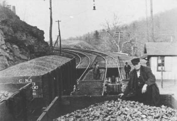
In the pre-regulatory days of mining, little thought was given to the negative impacts mining could have on both people and lands, but it provided employment for people throughout the region.
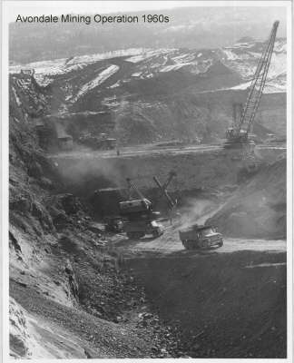
The Avondale Mine was at one time an active strip mine until the 1960s. Once dormant, it became a popular site for illegally dumping garbage.
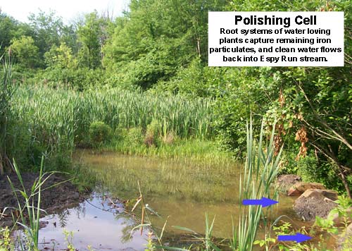
Espy Run Wetlands Polishing Cell
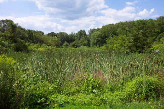
Espy Run Wetlands
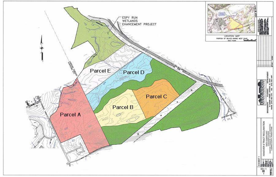
Hanover 9 All Parcels